
From stockpile analysis, to topography; pavement assessments to progress documentation…
*
From stockpile analysis, to topography; pavement assessments to progress documentation… *
YOU CAN’T MANAGE WHAT YOU CAN’T MEASURE
Looking up is what we do, and we bring that elevated perspective to every project. From pavement assessments to digital twins, we deliver data you can trust and insights you can act on.
Check out our services below to see how we can partner with you next…on the ground or in the sky.
-
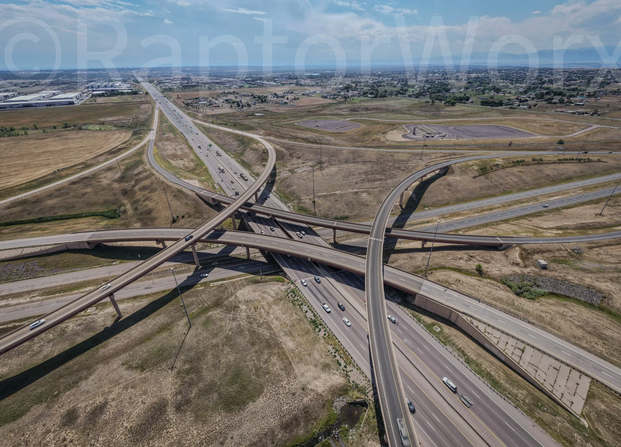
Know the state of your pavement before the cracks show.
We conduct Pavement Condition Index (PCI) assessments to evaluate the current condition of your pavement, recommend treatments, and help you plan your 5-year maintenance budget with precision. Our aerial inspections provide accurate, high-resolution data so you can make informed, cost-effective decisions about your infrastructure. -
Aggregates, tailing piles, and fill dirt… how do yours stack up?
We offer volumetric stockpile assessments that are safer, faster, and more accurate than traditional methods. Whether you're managing materials at a construction site, quarry, or landfill, our drone-captured data ensures reliable inventory tracking, compliance, and operational efficiency. -
A clear start makes for a solid finish.
Our pre-construction drone services offer high-resolution imagery, mapping, and 3D modeling to give your team an accurate snapshot of existing site conditions. When you know where you're starting from: terrain, assets, access points, and more. This will leave you better positioned to manage risk and plan smarter for what's ahead. -
Bring your site to life — virtually.
Our digital twin technology creates an interactive, photorealistic 3D model of your asset or project site. Perfect for construction monitoring, remote inspections, or stakeholder engagement, these dynamic replicas allow you to zoom, rotate, measure, and annotate, all from your screen. Gain deeper insights, reduce site visits, and collaborate in real time with unmatched clarity. -
Professional imagery with a purpose.
Capture stunning aerial visuals that document your site's development over time. Ideal for marketing, stakeholder reporting, investor updates, or internal documentation, our drone photography services offer a bird's-eye view of your progress, milestones, and on-the-ground success. -
Access matters — and compliance does too.
We use aerial and ground-level imagery to support ADA (Americans with Disabilities Act) compliance audits, helping you identify accessibility issues like uneven surfaces, inadequate ramp slopes, or non-compliant signage. Our precise, visual data supports engineers, property owners, and planners in maintaining spaces that meet regulatory standards and serve all users equitably.
